Visicom is a global provider of digital mapping products
We have been producing high quality geodata for telecom and GIS markets since 2000
What we do
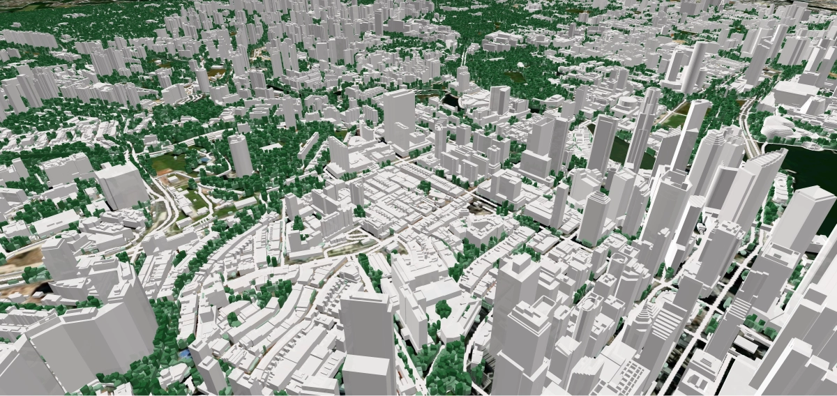
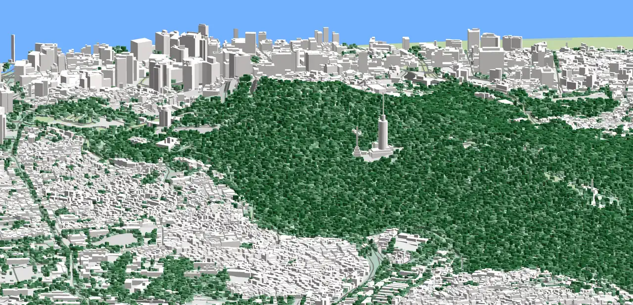
3D City Models
We produce Digital 3D maps (LOD1, LOD2) for any territory, providing customized solutions for each client.
Digital Maps For Telecom (RF Map)
Starting with the implementation of the 2G networks and further deployment 3G, 4G and 5G ones we support our customers by providing them with highly accurate geospatial data.
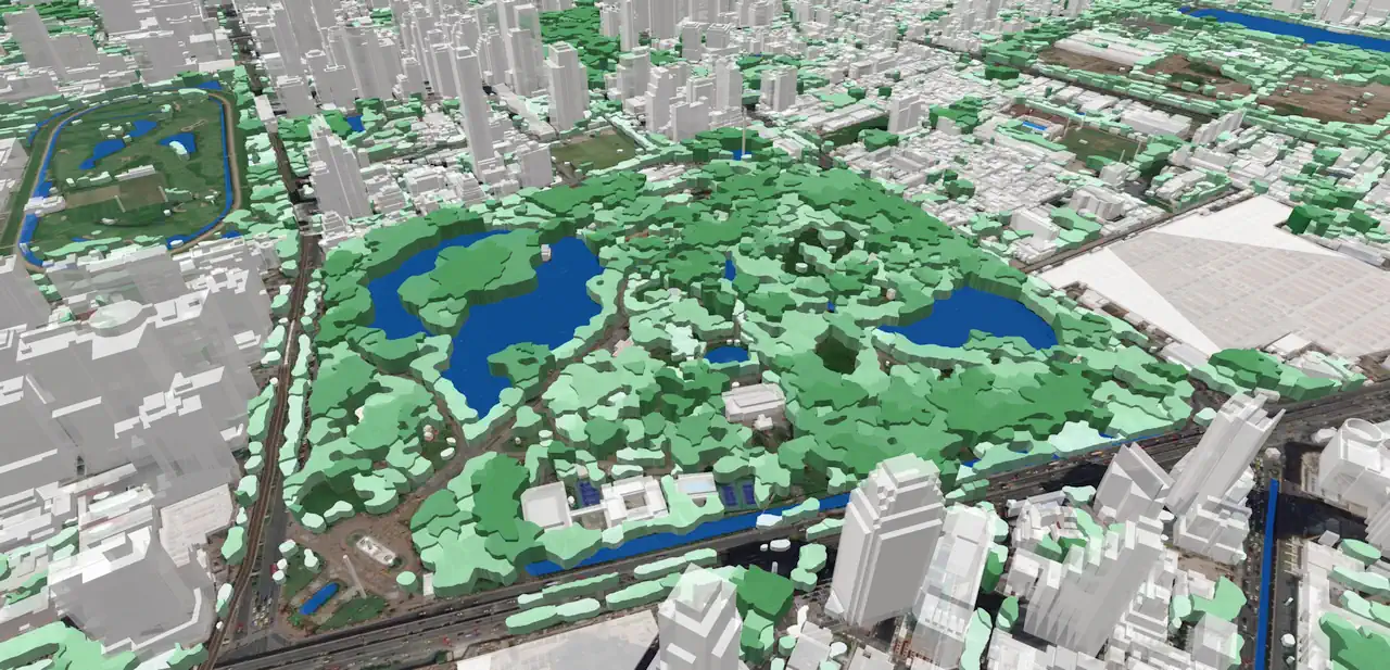
2D and 3D Extraction
Depending on project goal and requirements, they can be represented as 2D outlines or 3D objects with absolute height as an assigned attribute.
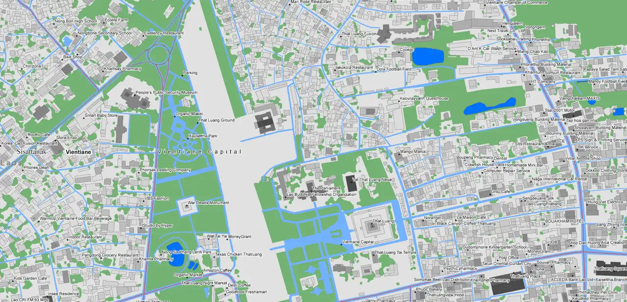
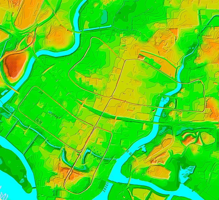
Geospatial Data
Visicom vector data include many types of geographical datasets of the most popular scales and GIS formats. Digital Maps may be customized according to customers’ specific needs. Our production capabilities are not limited to any region.
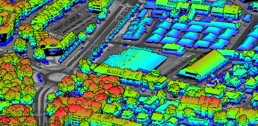
LiDAR Data Processing
We specialize in classifying LiDAR data to identify key features such as terrain, hydrology, vegetation, buildings, roads, PTLs, and other infrastructure elements

RailGeoKit: Accurate mapping of railway networks
Digital 2.5D / 3D Maps for Railway Infrastructure Mapping a route to 5G rail corridors is a key step in this process, enabling precise planning of network infrastructure to ensure full coverage and high quality of service.
Whom we serve

Telecom
The rapid development of new telecommunication generation – 5G networks, enabling humanity to enter to the contemporary era of connection and data interaction, is only possible with high-quality 3D cities models ensuring adequate signal radio planning stages, and as a result smooth functioning. Visicom 3D Geodata adapted to 5G networks demands show all type terrain features, as well as detailed 3D buildings and 3D canopies High-quality and up-to-date maps produced for telecom purposes, are fitted to advanced requirements of cmWave and mmWave frequencies..

Smart Cities IoT
5G ensures making networks several times faster, increasing network capacity, and opening possibilities to cover not only dense built-up territories in cities but also suburbs and villages. It is going to really unlock the potential of IoT and Smart city development, connecting all people and all things in our ordinary life: transport, energetics, healthcare, manufacturing, business, public safety, etc. Visicom is experienced in generating 3D buildings at different levels of detail (LOD) along with 3D vegetation and other geodata about the urban environment..

Architecture
3D modelling is an essential part of the architecture design industry, providing a detailed visual representation of the built environment and urban landscapes. Visicom supports architects and engineers in multiple industries with precise and accurate geodata: 3D Buildings, 3D Bridge and 3D Tree models Landscape and Terrain features Vector data of Streets and Roads networks POIs (Objects of city infrastructure) We provide ready-to-use 3D maps for urgent projects and produce any other layers on your request. .

What we've already done
0+
3D City Models
0+
2D Urban Models
0+
Countrywide model for regional planning
Get the information about available maps for cities and countries over the world


Who we are
Visicom company is a leading global data provider of the wide range of Digital Mapping Products
We produce high-quality geodata for telecommunication market, transport management, logistics, LBS, geomarketing, navigation, etc. Our innovative GIS solutions have been meeting demands in geosimulation and spatial calculations execution within various projects objectives for more than 20 years.

Our Benefits
High quality and accuracy
Highly competitive and flexible prices
Support of all major RF planning tools and GIS formats
Provision of any non-standard solutions
Meeting all customer requirements
What’s new
The Role Of Elevation Data In Building Flood-Resilient Cities
12 Apr 2026
Floods are becoming one of the most serious and costly risks for cities worldwide. With climate change and rapid urban growth, they are happening more often and hitting harder. For many communities, the question is no longer if flooding will happen, but how prepared they are.
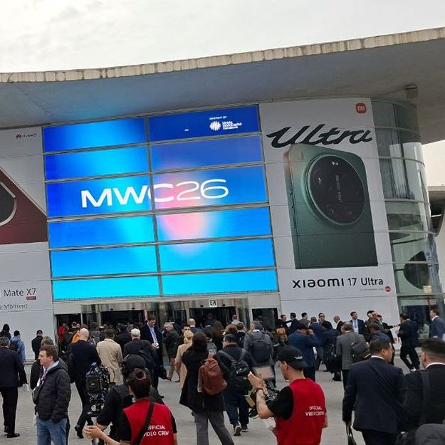
Visicom At MWC Barcelona 2026: Five Key Industry Trends
18 Mar 2026
This year’s MWC Barcelona was particularly special, marking 20 years of the event being held in the city. Over the past two decades, MWC has grown into one of the most important global platforms where the industry gathers to showcase new technologies and discuss where the telecom market is heading. The exhibition brought together nearly 105,000 participants from more than 200 countries, including companies, startups, mobile operators, and technology experts from around the world.

Visicom At Mwc Barcelona 2026: Ai-Driven Geospatial & Nationwide 3D Solutions
12 Feb 2026
This year, VISICOM will once again be present at Hall 5, Stand 5H33, together with its long-term partner boodmoe. At the stand, we will showcase our latest geospatial solutions for telecom operators, infrastructure companies, and digital transformation projects. With nearly 30 years of experience in cartography and GIS, VISICOM develops 2D, 2.5D, and 3D models covering entire countries. Our datasets are designed to ensure accuracy, consistency, and seamless integration into telecom and infrastructure planning systems. As digital infrastructure continues to expand, the demand for reliable nationwide geospatial data is steadily growing. VISICOM focuses on delivering high-resolution spatial datasets that support large-scale network planning and investment decisions.

Contact us
Please, contact us directly if you have question
We always reply within 24 hours
Visicom Headquarter
![]() 25/2 Velyka Zhytomyrska Str., Kyiv, Ukraine, 01001
25/2 Velyka Zhytomyrska Str., Kyiv, Ukraine, 01001
Contact information